(Simone Mühl)
“The cultural landscape and settlement patterns at the Little Zab, Iraq” at the University of Heidelberg is a project aiming at the archaeological investigation of the Assyrian Heartland by means of new material from recent archaeological investigations and its integration to landscape archaeology at the eastern Tigris area.
Archaeological Investigations
In 2007 construction works should have started on a bigger dam project planned by the former government of Iraq. The so-called “Makhul Dam” was supposed to flood an area of about 260 km2 endangering not only well known sites like the Middle
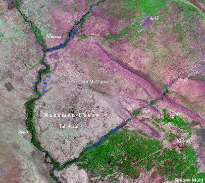
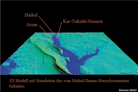
Assyrian city of Kar- Tukulti-Ninurta but many others as well, to disappear under water. Therefore several sites threatened by destruction had been surveyed and excavated by the Directorate of Antiquities and Heritage, Baghdad. Those excavations and survey results offer a huge amount of new material which brings much information about the region: its cultural and settlement history. It is now being studied and evaluated in Heidelberg, in cooperation with Iraqi colleagues.
63 sites had been discovered during the survey, of those 15 had been excavated. Their date from the early Chalcolithic to the early Islamic periods, providing also evidence for periods which have not been attested or investigated sufficiently in the region’s biggest settlements like Ashur and Kar-Tukulti-Ninurta. This new information will increase and supplement our knowledge about Assyria’s heartland which had been previously dominated by research in the region’s centers.
|
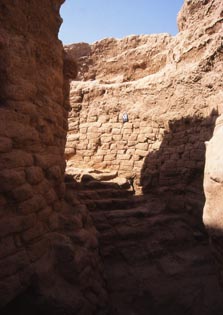
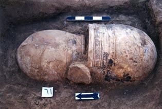
Among investigated sites two different round buildings dating to the Early Bronze Age are outstanding: One in Tall al-Namil (Sulaiman 2001-02) and one in Tall al-Faras. But also Middle Assyrian houses, graves and tombs in settlements like Tall Farha, Tall al-Nul or Tall Hanas seem to be of importace, as relevant for studying the extent of Assyria in these times. |
||||||||
 |
||||||||
 |
||||||||
|
To the left: a middle Assyrian jar burial in Tall Hanas (Photo: B.S. Sulaiman), to the right: staicase in the round buildings in Tall al- Namil (Photo: P.A. Miglus). |
||||||||
 |
||||||||
|
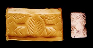
Various findings, like cylinder seals, give a lively impression of craftsmanship, but furthermore they offer important information about regional and supra-regional trade, and its changes through time. When found in archaeological deposits, they constitute valuable and precise dating tool. |
||||||||
Landscape Archaeology
The investigation of the material that came from those excavations can be linked with the data from landscape archaeology and gives us interesting information about the landscape’s spatial organisation and its formation in the hinterland of Ashur. Furthermore, interest focuses on the region’s embedding within the supra-regional network over several periods and on the relations between Assyria and Babylonia.
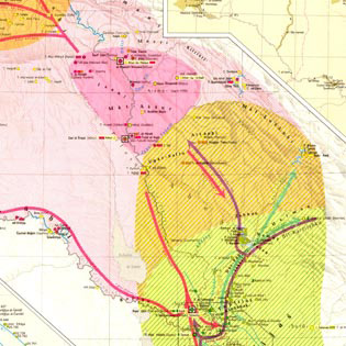
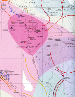
Assyria and Babylonia in the 2nd half of the 2nd millennium and in the 1st millennium (crops from TAVO B III 7, on the left and TAVO BIV 10, on the right).
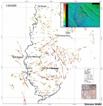
Satellite images taken in the sixties of the last century show, to a trained eye, the settlements of antiquity, but also hollow ways which were part of local and supra-regional networks.
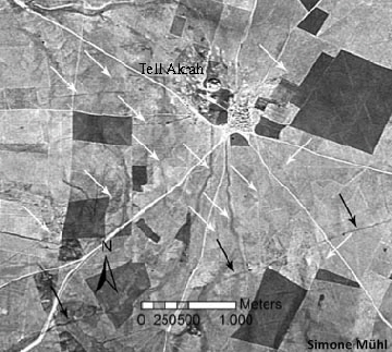
Mapping all hollow ways visible on satellite images shows a network of routes very clearly. This network can be set in chronological and spatial relation to the region’s centers, but it also shows connections between smaller settlements.
Apart from settlements and hollow ways connecting them, another landscape feature is traceable: canals, mainly distributing water from the Tigris to the river terraces for agriculture. They could be also used for fishing. A canal possibly dating to the Neo-Assyrian period, close to the Parthian/Sasanian and early Islamic settlement Wadiya al-Kurdiya al-Sura, might have been navigable, to shortcut the meandering Tigris.
Mahmud El-Amin started a short investigation at Tall Akrah (Mallowan/El-Amin 1950) which must have been an important site in antiquity in the plain of Makhmur. The tell is visible as center of many radial hollows (white arrows). A broader way, which is traceable over many kilometers, is passing the tell in the south (black arrows). It could be termed as Assyrian “hur sharri”, the royal road system of highways in Assyrian antiquity. These roads served as important traffic veins for military and economic control over the territory under the Assyrian king’s authority.
References:
- M. Altaweel, The Imperial Landscape of Ashur: Settlement and Land Use in the Assyrian Heartland, Heidelberger Studien zum Alten Orient 11 (2008).
- M. E. L. Mallowan & M. El-Amin, Soundings in the Makhmur Plain. Part 1, Sumer 5 (1949), 145-153.
- M. E. L. Mallowan & M. El-Amin, Soundings in the Makhmur Plain. Part 2, Sumer 6 (1950), 55-90.
- B. S. Sulaiman, التنقیبات في تل النمل (“Excavations in Tall al-Namil”), Sumer 52 (2004), 1-50.
- B. S. Sulaiman, تنقيبات عراقية في حوض سد مكحول (“Irakische Ausgrabungen im Makhul-Staudammgebiet”, Heidelberger Studien zum Alten Orient 12 (2010).
- S. Mühl, Siedlungsgeschichte im mittleren Osttigrisgebiet. Vom Neolithikum bis in die neuassyrische Zeit, Abhandlungen der Deutschen Orient-Gesellschaft 28 (2013).
The project was funded by the Gerda Henkel Stiftung.